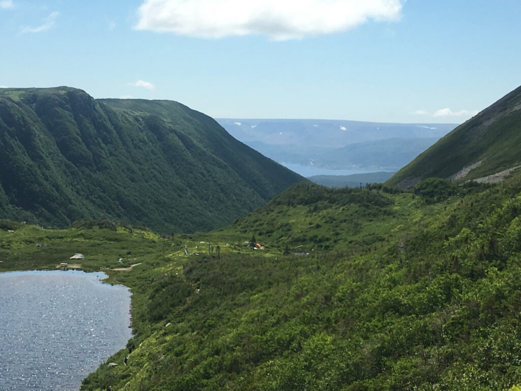
Gros Morne Mountain is the iconic summit hike in Gros Morne National Park, Newfoundland—a full-day, legs-on-fire kind of climb that rewards you with a rare arctic-alpine plateau and sweeping views over Ten Mile Pond and the Long Range Mountains. This guide covers the full route (Approach + Summit loop), spring closure dates, seasonal conditions, weather checks, what to pack, easy turnaround points, camping at Ferry Gulch, and options for guided hikes.
Ads are how we keep our blog free for you to enjoy. We also use affiliate links; if you make a purchase through them, we may receive a small commission at no cost to you.
Quick facts: Gros Morne Mountain hike (at a glance)
- Trail name: Gros Morne Mountain Trail (aka James Callaghan Trail)
- Total distance: 17 km loop (Approach + Summit loop)
- Time: 6–8.5 hours (typical)
- Elevation gain: about 1000 m
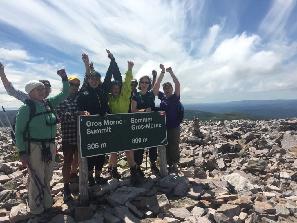
- Summit elevation (how high is Gros Morne Mountain?): 806 m
- Dogs: Strongly discouraged — but if you do, it must be on leash.
- Spring closure: Summit trail closed May 1 – June 28 (Approach remains open)
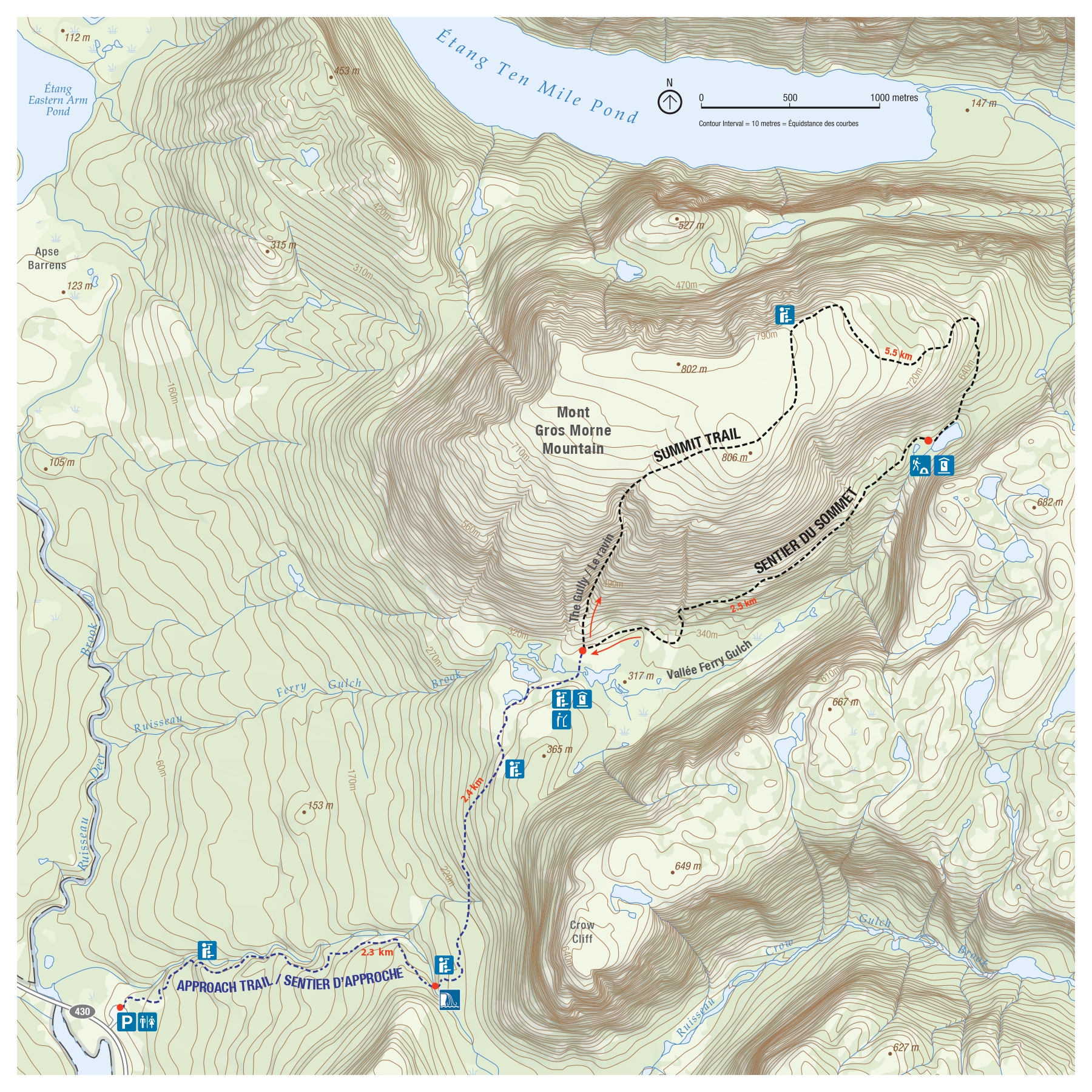
Trail overview: Approach Trail + Summit Trail loop (the classic route)
Think of this hike as two hikes stitched together:
1) Gros Morne Approach Trail (moderate)
- Distance: 9 km return to the viewing platform (base of the mountain)
- What it’s like: forest walking along Crow Gulch Brook, waterfalls, and big mountain views.
2) Gros Morne Summit Trail loop (difficult)
- Distance: 8 km loop from the viewing platform
- What it’s like: a steep, rocky climb up a gully to the exposed plateau, then a rougher descent that drops you down through Ferry Gulch.
Put together, that’s the well-known Gros Morne Mountain hike length: 17 km of “earned views.”
Is Gros Morne Mountain closed? Seasonal Access
Spring (May 1 to June 28): summit closure
To protect wildlife during critical weeks, the Gros Morne Summit trail is closed beginning May 1 and re-opens June 28 each year. The Approach Trail to the viewing platform at the base stays available and makes an excellent shorter hike.
Summer + fall (late June to October): prime hiking season
This is when most people tackle the full summit loop—long daylight, clearer trails, and the best chance of stable conditions. July through October is the best window for this trail.
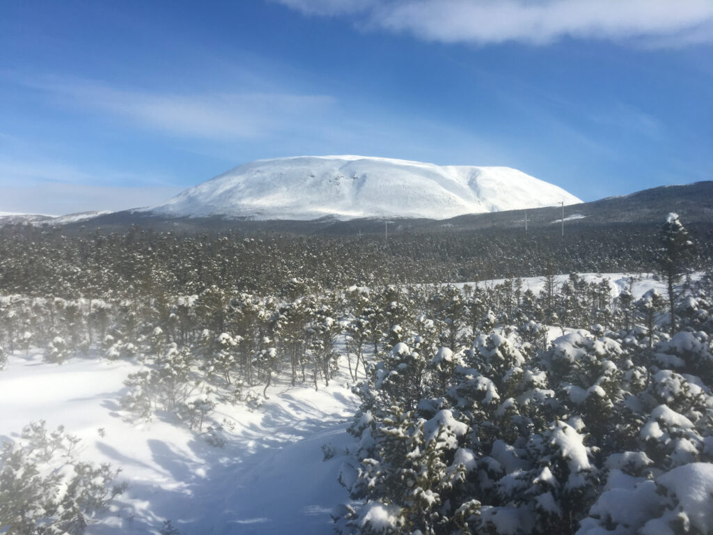
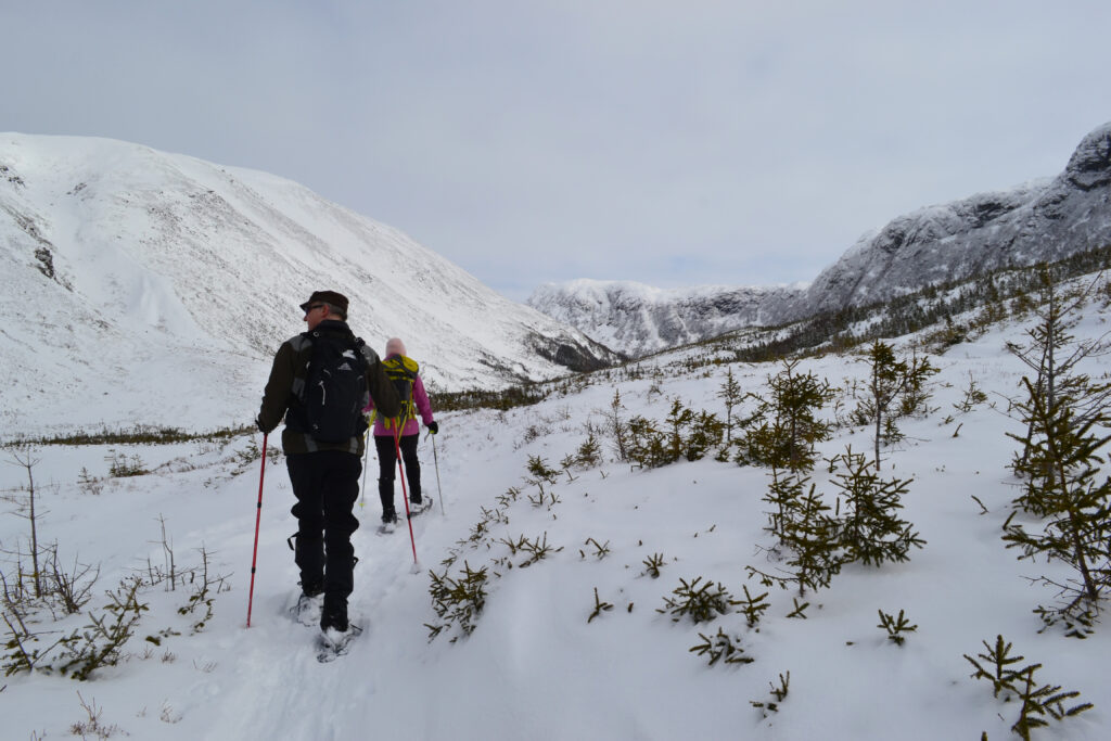
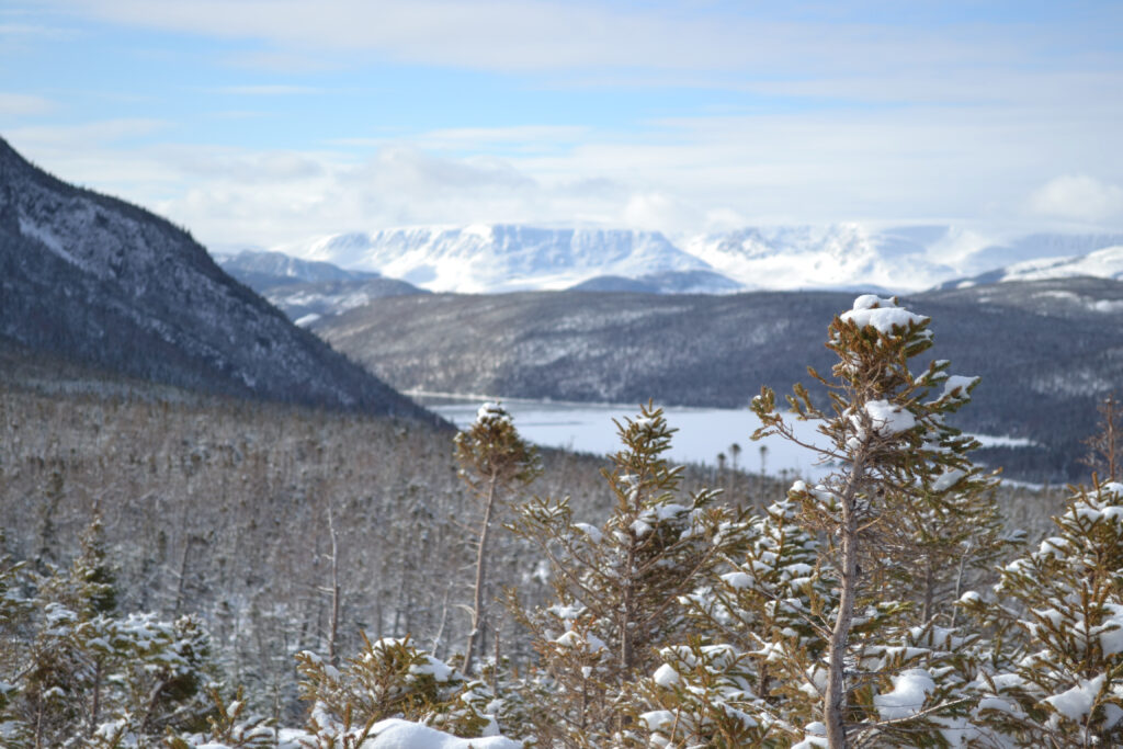
Winter (November – April): the park is open, but the summit is a serious “maybe”
The summit is not recommended for general hiking due to ice/snow and avalanche terrain. If you’re considering any winter attempt, treat it as a specialized outing that requires avalanche safety training and equipment and defer to current Parks Canada trail conditions and Avalanche Canada NL. Be prepared to self-rescue.
Where is the trailhead + parking?
The hike starts from the Gros Morne Mountain trailhead / parking lot in Gros Morne National Park (between matti michtel and East Arm Brook Bridge). Expect it to fill up on peak summer days—go early for parking and for calmer weather on the summit.
Step-by-Step Route Guide (with easy turnaround points)
Segment A: Trailhead → “bridge + waterfall” turnaround (easy short option)
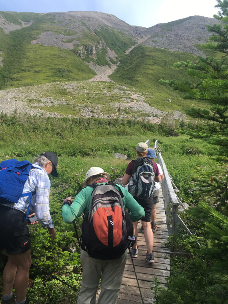
On the Approach Trail, there’s a bridge overlooking a waterfall that Parks Canada highlights as a great destination for a shorter hike. If you’re hiking with kids, unsure about weather, or starting late, this is a perfect “no-pressure” turnaround.
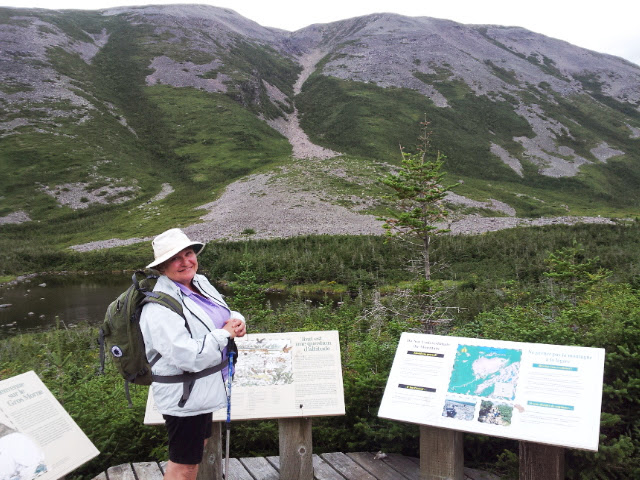
Segment B: Bridge → Viewing platform at the base (Approach Trail finish)
Keep following the Approach Trail as it climbs toward the base of the mountain. This is an excellent snowshoe route in winter and the best otion if you’re hiking with dogs and/or kids. The viewing platform is a major decision point:
- Feeling great + conditions look good? Continue to the summit loop.
- Cloud rolling in / wind picking up? Turn around here and still count it as a fantastic hike.
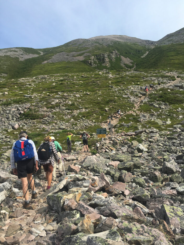
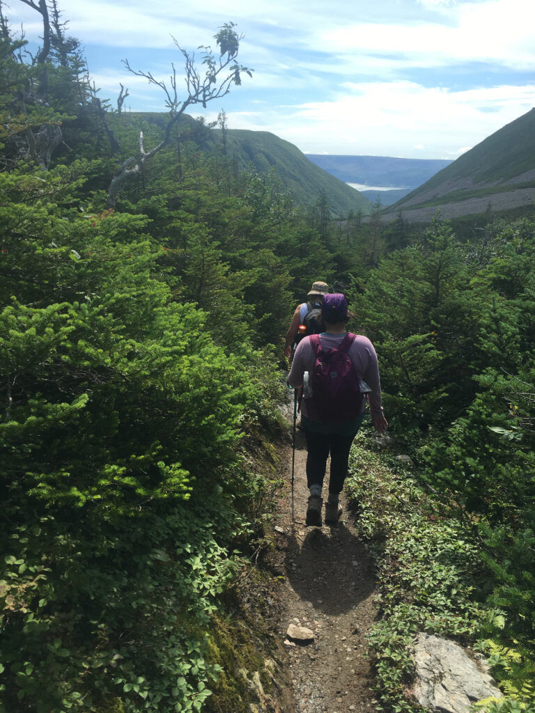
Segment C: The gully climb (the “earn it” section)
From the viewing platform, the Summit loop climbs steeply over loose rock/shale toward the plateau. This is where:
- your pace slows
- layers come off/go back on
- the wind usually shows up
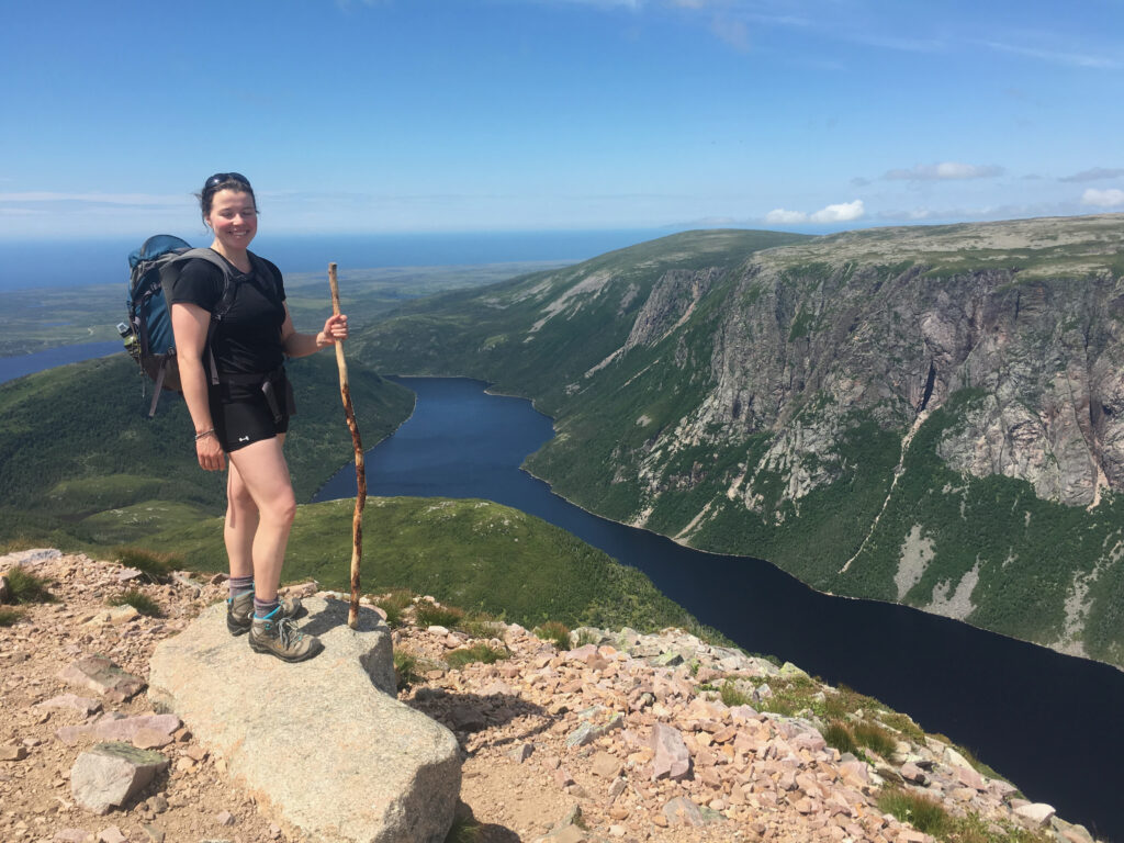
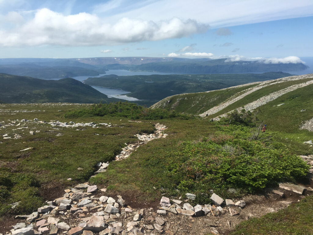
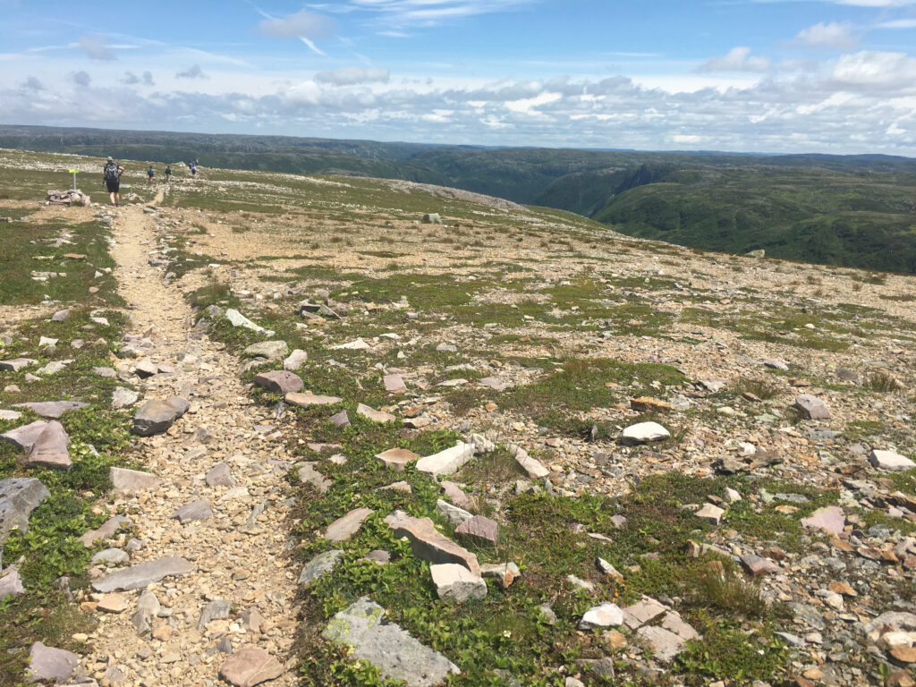
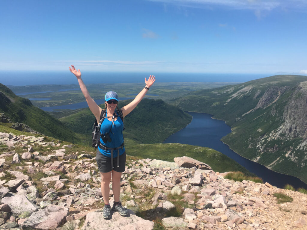
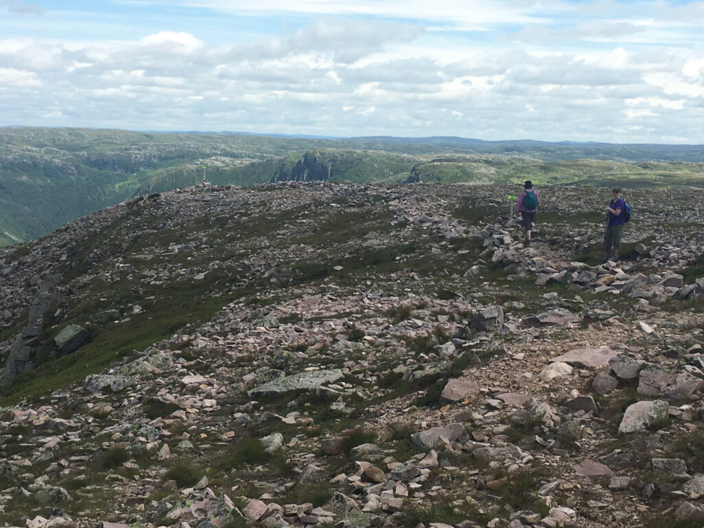
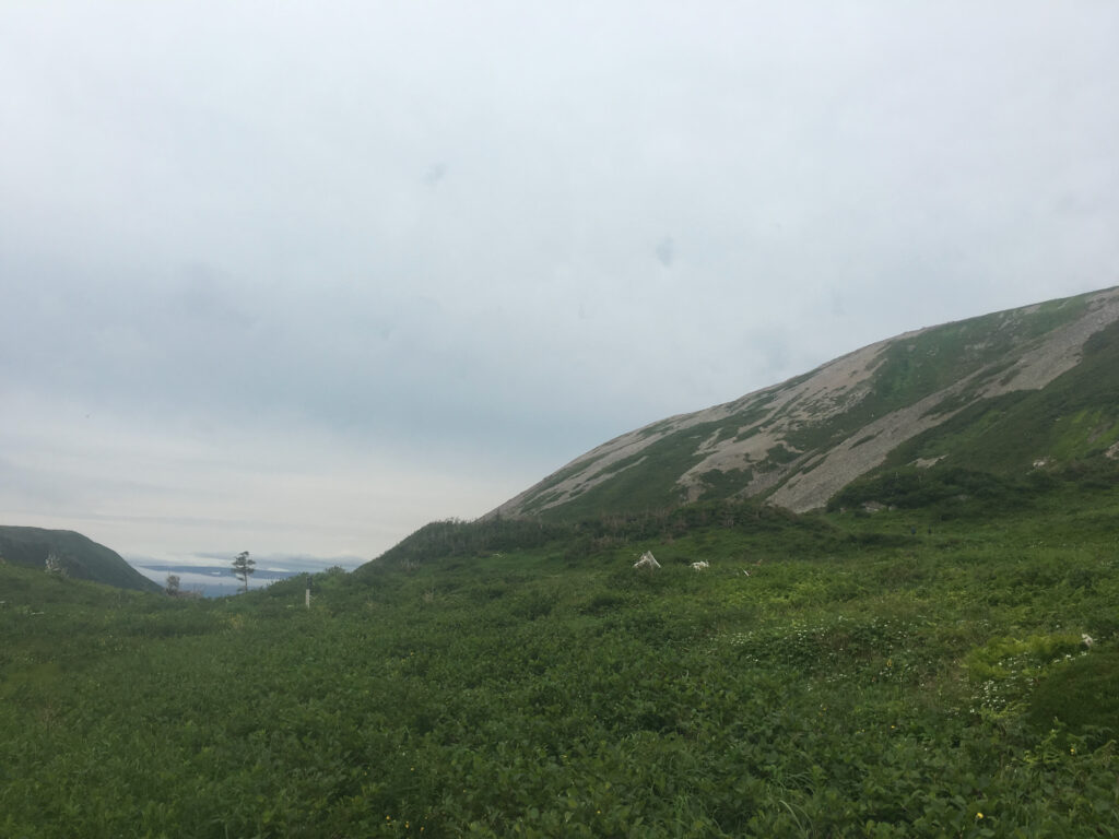
Segment D: The arctic-alpine plateau + summit area
Up top, you’ll be walking across a harsh, beautiful plateau with huge views—when visibility is good. The summit can be in cloud, and poor visibility makes safe travel difficult. There are trail markers, so be sure to pay close attention and have GPS map app (like Gaia GPS) with the route loaded to ensure you stay on the track. People have fallen off the mountain!
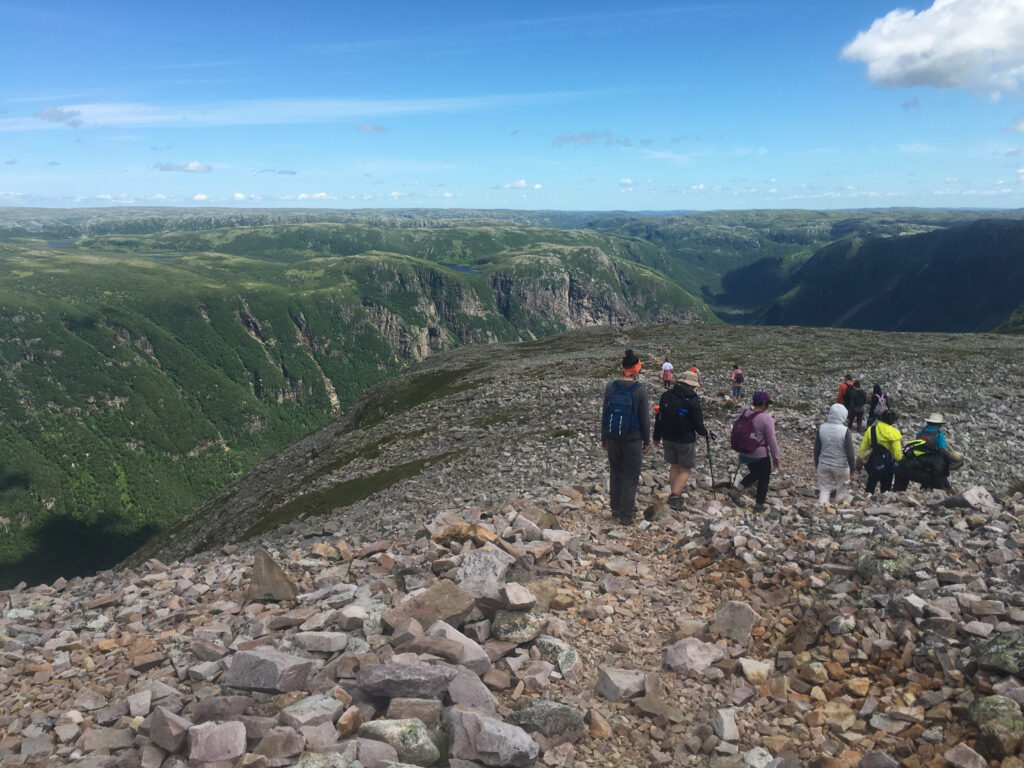
Segment E: Descent through Ferry Gulch (rough + careful footing)
The descent begins with a lot of stairs and transitions from rocky subarctic tundra-like to dirt and stunted spruce again. you drop off the mountain at the Ferry Gluch campsite (camping info below) and outhouse. This is a great place for a break – pee, eat a snack, and gear up for the next section. From the campsite back to the viewing platform is rugged and boulder-strewn in places. This is the hardest section of the trail in my opinion. When I used to guide groups, this is where the knees got loud, the energy drops (eat your snacks!), and if it’s raining, EVERYTHING is very slippery and treacherous! Take your time and keep your blood sugar up.
Segment F: Descent from Viewing Platform back to the Parking lot
Now you’re back on the ‘new’ section of the trail and easiest segment. It’s all downhill from here on a crushed gravel path, with outhouses along the way.
Weather + trail conditions: what to check (and where)
Gros Morne is famous for “all four seasons in one day,” and that’s extra true on an exposed mountain.
Before you go, check:
- Local weather forecast (Rocky Harbour) for:
- wind speeds (greater than 50km/hr = do not hike the summit)
- visibility (fog – when it will clear vs. roll in)
- rain amount (greater than 5mm in a day = do not hike)
- Parks Canada trail conditions (Gros Morne National Park)
On the hike, watch for:
- summit disappearing into cloud/fog as you approach the gully climb (consider turning around if the weather called for it to stay or get worse)
- winds increasing on the upper mountain as you climb up and out of the gully
- wet rock on the gully and return through Ferry Gultch (slippery and slow)
If visibility is dropping at the viewing platform, that’s your sign to treat the Approach as the hike and save the summit for another day.
What to bring: Gros Morne Mountain hiking checklist
Parks Canada’s own “comfort and safety” notes are blunt: there is no food, shelter, or water available on the mountain, and it’s cooler/windier up top.
Here’s a practical packing list for this trail:
Clothing (layers win)
- Waterproof/windproof shell jacket (non-negotiable) + waterproof pants
- Warm mid-layer top (even in summer)
- Warm Hat + gloves (yes, even July on a windy day)
- Extra socks
Food + water
- At least 3L water per person (more on hot days)
- Lunch + plenty of snacks (aim for “eat every hour” fuel)
Gear
- Sturdy hiking boots (broken in)
- Basic first aid (blister management, ibuprofen/Tylenol, etc.)
- Bathroom kit (TP/kleenex + waste bags + hand sanitizer)
- Headlamp (insurance if you’re slower than expected)
- Trekking poles (especially helpful on the descent)
- Offline map / downloaded trail map (I recommend Gaia GPS app)
How long does it take to hike Gros Morne Mountain?
Most hikers should plan for 6–8.5 hours for the full loop. Add time for:
- fog delays on the plateau
- snack breaks
- cautious footing on the boulder descent
- slippery everything is it’s raining
A good strategy: start early enough that you’re not racing daylight, and build in a firm turnaround time at the viewing platform.
Trail etiquette on Gros Morne Mountain
Gros Morne Mountain is wild, exposed, and ecologically sensitive. A few simple habits keep the trail beautiful—and keep wildlife and other hikers safe.
Pack it in, pack it out (always).
There are no garbage cans on the mountain. Everything you bring—including snack wrappers, fruit peels, tissues, and “biodegradable” items—needs to come back out with you. If you notice litter, grab it if you can. Having a dog poop bag or two is a simple way to separate your trash while hiking.
Leave No Trace basics (the stuff that matters here).
- Stay on the established trail to prevent widening the path and trampling fragile alpine plants.
- Don’t build new rock piles or shortcuts—cairns are navigation tools, not souvenirs.
- Leave what you find (rocks, plants, berries). The plateau is a rare arctic-alpine environment and recovers slowly.
Bathroom breaks: do it properly.
Plan ahead—there are only 2 pit toilets once you leave the parking lot but it’s BYOTP!
- Use the provided toilets (please!!) and do your part to keep them clean (aka if you pee on the seat, wipe it off)
- If you need to pee: go off-trail and away from water sources.
- If you need to go #2: move well off-trail (at least 70 big steps / ~60–70 m from water and the trail), dig a small hole 15–20 cm deep with a stick, and cover it completely afterward.
- Pack out toilet paper. It doesn’t decompose quickly here and animals dig it up. Bring a small zip bag/dog poop bag (double-bag if you want) for used TP.
Tip: make a mini bathroom kit in a large zip lock with; small pack of Kleenex + roll of dog poop baggies + hand sanitizer (add tampons/pads for the ladies).
Be considerate on narrow sections.
- Uphill hikers have the right of way, but use common sense—step aside when it’s safe and let faster groups pass.
- Keep music off (or low); the sound carries and wildlife lives here too.
Respect wildlife—from a distance.
Never feed animals, don’t chase them for photos, and give them space. This is their home. And that moose isn’t friendly!
Bringing your dog to Gros Morne Mountain
Dogs are not recommended on the Summit Trail. The presence of dogs on the mountain can disturb the unique wildlife that call Gros Morne Mountain home—please consider leaving your dog at home.
The hike to the summit is also physically demanding for dogs. The rocky terrain can be hard on paws, and weather conditions can change quickly.
If you do bring your dog, these are the non-negotiables:
- Your dog must always be under physical control on a leash, so they do not harass or harm wildlife or disturb other hikers.
- You must pick up and pack out dog waste. (Bring bags and a small zip bag for carrying them out.)
Before bringing your dog, ask yourself: If my dog were injured on the trail, could I carry them back to the parking lot? If not, please reconsider bringing your dog. You can board them in Deer Lake for the day or hike a different trail.
Biking the Gros Morne Mountain Trail (Approach Trail)
This trail isn’t built as a bike trail, but the Approach Trail from the parking lot to the viewing platform can be a really fun out-and-back ride in the shoulder seasons—especially spring (before the summit reopens) or fall when the trail is quieter.
A few important notes before you go:
What’s actually bikable
- Bikeable section: Parking lot → Viewing platform (Approach Trail only)
- Not bikeable / not recommended: Summit Trail loop (too steep, rocky, and hiker-focused)
In other words: you’re biking the approach, not the mountain.
Best time to bike
- Spring: great option during the summit closure window when fewer hikers are heading up beyond the platform.
- Fall: cooler temps, fewer crowds, and a nice way to see the valley.
- Summer: not recommended. The trail is busy with hikers, and bikes add unnecessary risk and stress on a narrow, shared-use route.
Bike etiquette on a shared hiking trail
If you’re biking here, you’re a guest on a hiking-first trail—etiquette matters.
- Yield early and politely. Slow down well before people, announce yourself calmly (“Bike coming up behind you!”), and wait for a safe spot to pass.
- Downhill yields to uphill hikers and bikers. If you’re descending, be ready to stop and step aside.
- No bombing descents. Keep speed low—sightlines can be short and surfaces can be loose or wet.
- Stay on the main tread. Don’t widen the trail to go around puddles—ride through or dismount and walk.
- Leave no trace. Pack out everything, including food scraps and any repair waste (tube scraps, CO₂ cartridges, etc.).
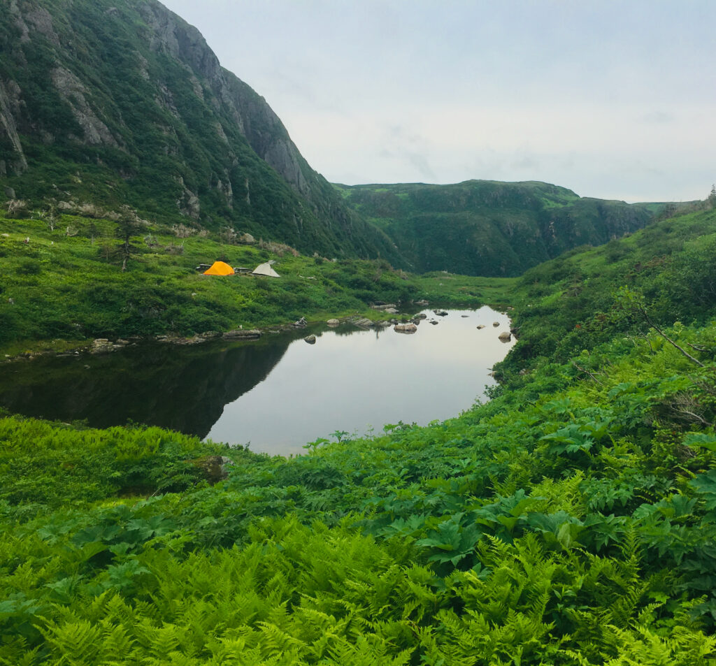
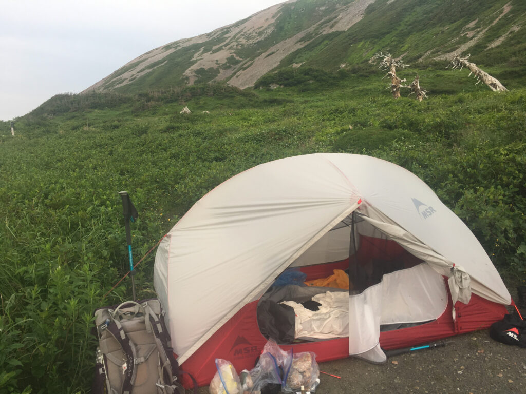
Camping at Ferry Gulch (primitive camping option)
Yes—you can camp at Ferry Gulch (primitive/backcountry style), but you’ll need the proper permit/registration.
How to reach the Ferry Gulch campsite
Parks Canada describes it like this:
- Hike 4.5 km on the Approach Trail to the base of the mountain
- Turn LEFT onto the Summit Trail (do not go up the gully) and continue another 2.5 km to reach Ferry Gulch
Important: this is primitive camping—go prepared, follow Leave No Trace, and confirm current registration/permitting requirements with the park before heading out.
Guided hikes: options if you want a local expert
If you’d rather not navigate conditions and pacing solo—or you want geology + park stories layered in—there are multiple guided hike options in and around Gros Morne National Park:
- Tour Gros Morne – Guided Day Hikes
- Wild Gros Morne – Gros Morne Mountain Day Hike
- Gros Morne Adventures – Guided Day Hikes
Gros Morne Mountain Hike FAQ
How tall is Gros Morne Mountain?
The summit is 806 metres above sea level.
Can I do a shorter Gros Morne Mountain hike?
Absolutely. The Approach Trail alone (to the base/viewing platform) is a rewarding hike, and the bridge/waterfall is a popular shorter turnaround.
When does the trail to Gros Morne Mountain open?
The summit section re-opens late June every year after the spring wildlife closure (it closes May 1).
Are dogs allowed on Gros Morne Mountain?
Many hikers treat this as a no-dog trail due to park guidance and the rocky terrain. Parks Canada notes dogs are strongly discouraged because they stress wildlife and the terrain is hard on paws. Dogs are best included only for the Approach Trail section, not the summit.
Final tips for making this your best hike in Gros Morne
- Start early. You want time for weather to do its thing without rushing decisions.
- Treat the viewing platform as your “truth point.” If the summit is socked in, you’ll still have a great day on the Approach.
- Pack more water than you think. This is a long, exposed hike with no services.
- Check trail conditions the day you go. Especially outside peak July–Sept.
- In case of an emergency on the trail, call 1-877-852-3100.
Recommended Reads
Hike This: Lakeside Trail in Gander, Newfoundland
Welcome to Gander’s Gem of a Hike Tucked just minutes outside Gander, the Lakeside Trail is a 7.1 km forest-and-lakeshore ramble that delivers solid scenery, a touch of elevation, and enough berries and birdsong to keep things interesting. It’s your classic “not too hard, not too easy” trail—ideal for a solid half-day adventure or a…
Best Hikes in Gros Morne National Park
Gros Morne National Park, nestled on Newfoundland’s west coast, is a haven for hikers. Whether you’re in search of gentle boardwalks, rugged mountain climbs, or coastal views, the Gros Morne hiking trails offer some of the most varied and awe-inspiring landscapes in Canada. This blog showcases the top 4-5 trails we consider the Best Hikes…

Best Things To Do in Gros Morne National Park, Newfoundland
Gros Morne National Park is a place of breathtaking, rugged landscapes and endless adventure. Located on Newfoundland’s west coast, this UNESCO World Heritage Site is a paradise for hikers, wildlife lovers, and outdoor enthusiasts. Whether you’re trekking through ancient fjords, summiting Gros Morne Mountain, or exploring coastal fishing villages, there’s no shortage of ways to…